


A McKinney home can look settled while the land behind it is still part of a changing transportation plan. That does not automatically make the home a bad choice. A future road may improve access for one household and create a construction, noise, or view concern for another. The mistake is deciding from the fence line alone.
Quick answer: Before buying a home in McKinney, check the exact address against TxDOT, NTTA, Collin County, and City of McKinney planning maps. Separate a generalized planning line from a selected route and a funded construction project. Then verify the parcel through title, survey, contract documents, agency records, and a real visit before the deadlines in your agreement.

Watch the 15-minute companion video for the full map-checking walkthrough, then use this guide to build a file for a specific property.
What the selected US 380 route means
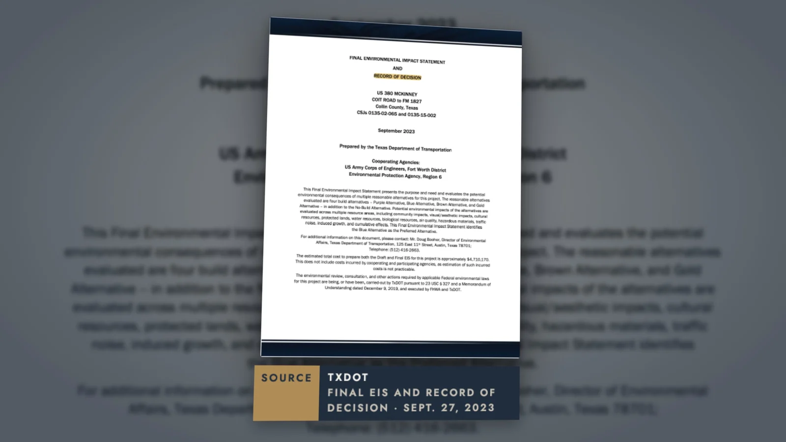
TxDOT selected the Blue Alternative for the US 380 project across north McKinney after its environmental review. The official project description generally connects existing US 380 near Coit Road on the west with existing US 380 near FM 1827 and New Hope Road on the east. A selected alternative is important evidence because it is more specific than an early concept. It still is not a parcel survey, a promise that every segment will be built at once, or a date certain for construction beside a particular home.
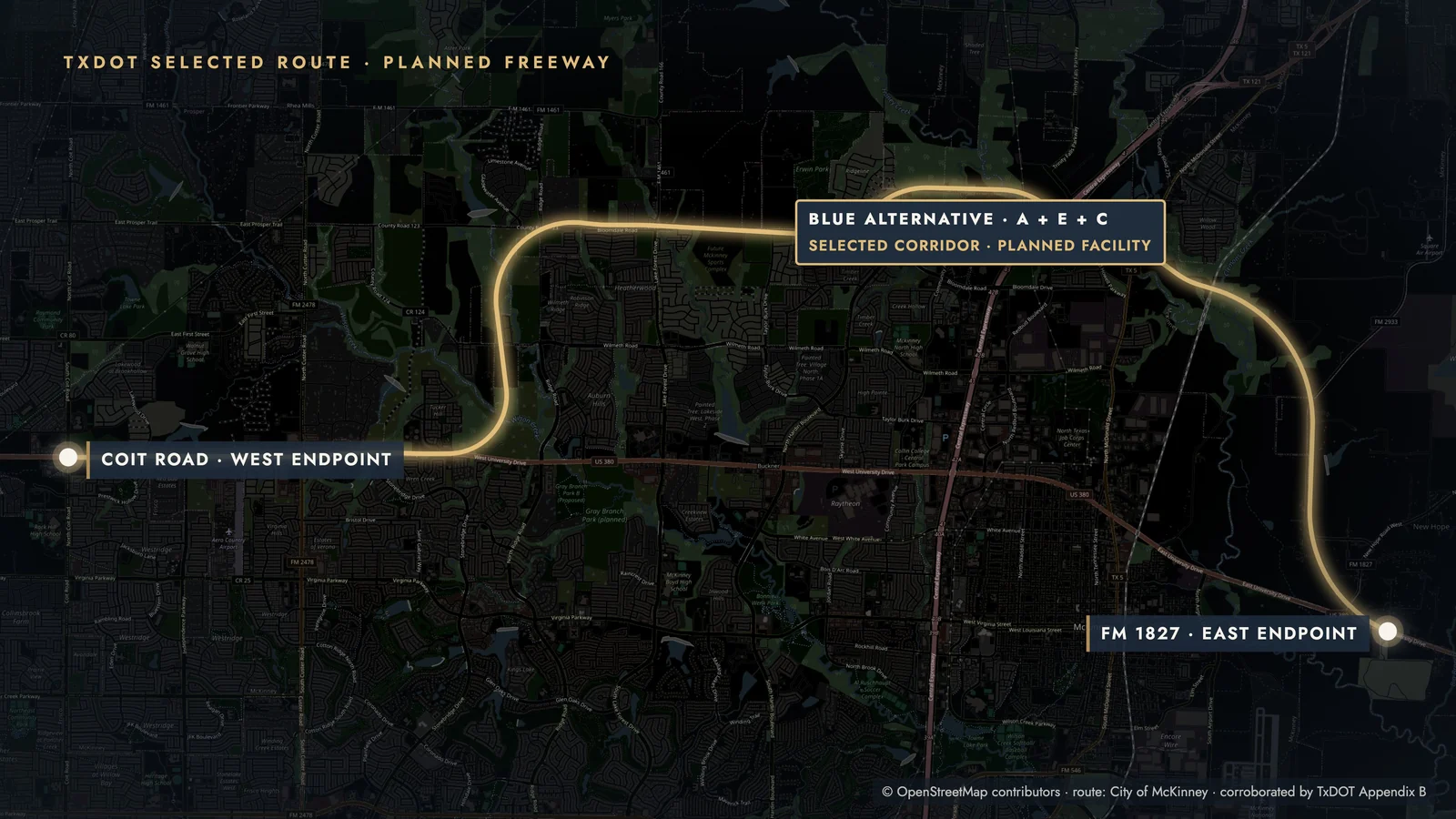
Source: TxDOT, US 380 from Coit Road to FM 1827, checked October 11, 2026. Project limits and delivery details should be confirmed on the current agency page.
The useful buyer question is not simply, “Is there a bypass?” It is, “What does the current official route show near this address, and what stage has that portion reached?” A route can matter before construction begins, but its practical effect depends on distance, grade, barriers, access points, design changes, project delivery, and what your family values.
A line on a map is not a construction schedule
Transportation projects move through multiple decisions. Those decisions can overlap, change, or apply differently to separate segments. Treating every line as a bulldozer-ready project exaggerates the evidence. Treating every unbuilt line as irrelevant ignores the reason the map exists.
The City of McKinney makes the same limitation clear in its thoroughfare planning materials: mapped alignments are generalized, may shift, and are not a site-specific determination. That makes the city map a starting point for a property question, not the final answer.
Source: City of McKinney, 2023 Master Thoroughfare Plan, dated December 19, 2023. The city says future alignments are generalized, may shift during engineering, and are not precise site-specific locations. Checked October 11, 2026.
The four-map check for a McKinney address
No single map owns every future-road question in and around McKinney. The published video uses four official systems because each answers a different part of the decision. Save the source link and the date you checked it so you can return to the same evidence later.
Use project pages and environmental exhibits to find selected highway alternatives, project limits, and formal decision documents.
Open the US 380 project pageCheck the tollway authority for current facilities and its own future-project information. Do not assume a county or city line is an NTTA commitment.
Open NTTAReview the county's planned 55-mile facility, reserved right of way, completed segments, and phased delivery information.
Open the Outer Loop pageUse the city planning layer to spot future thoroughfares near an address, then read the plan limitation before treating a line as exact.
Open the city map layerStart wide enough to see how the larger network fits together, then zoom to the house. A map screenshot cropped tightly around one parcel can hide where a route begins, ends, or connects. A map zoomed too far out can make a corridor look farther from the lot than it is. Record both views.
If you are also comparing a mature city with a more active development edge, the Frisco build-out guide uses the same principle: the exact address matters more than the city label. For special districts, fees, and other records that can vary by parcel, the Celina address-file guide shows how to organize a second layer of due diligence.
Screen the lot, not just the neighborhood
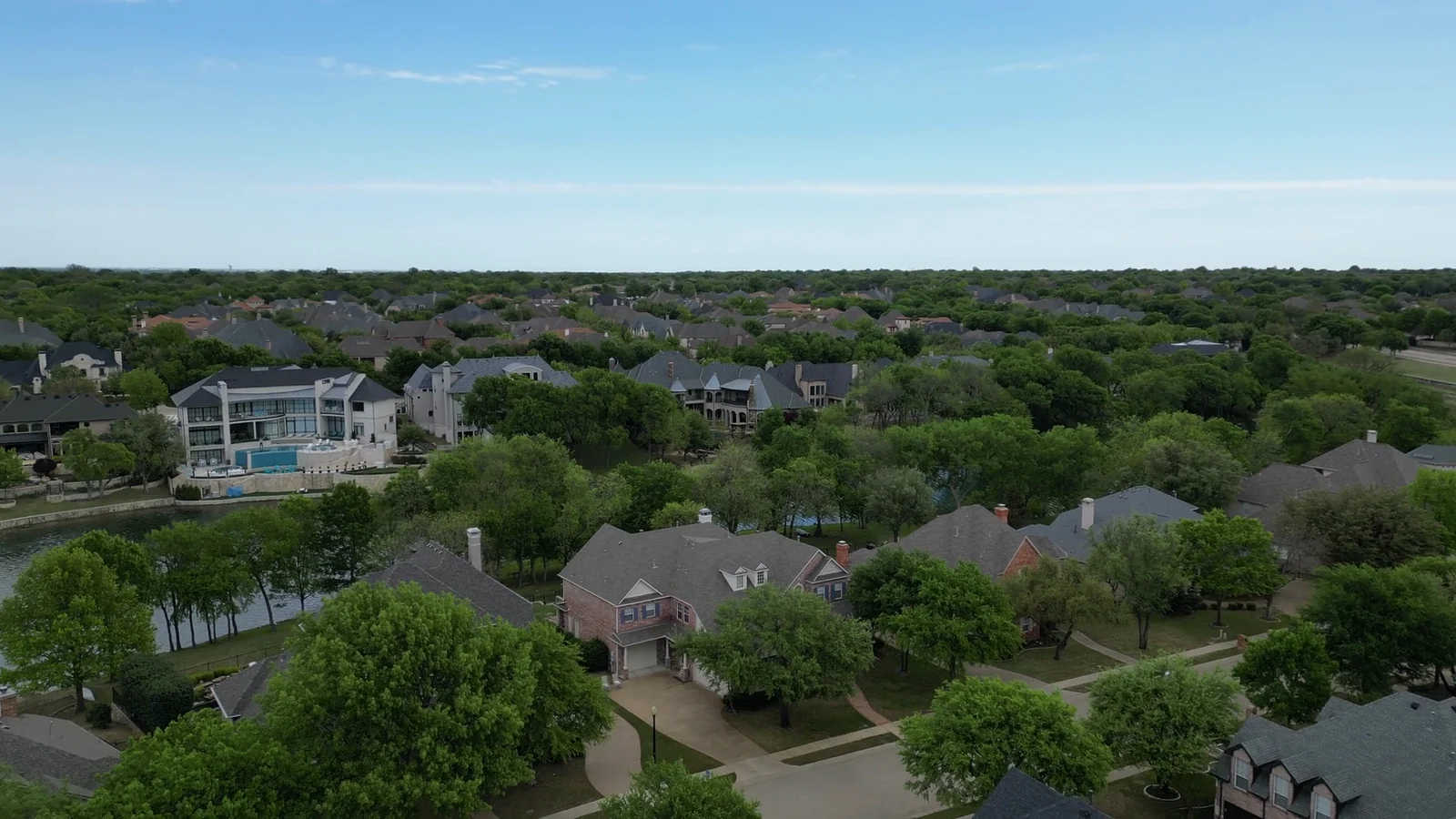
A neighborhood name can span very different edges, streets, and future conditions. One home may back to an internal greenbelt. Another may sit across open land that appears on a future thoroughfare map. Another may be near a corridor but separated by grade, distance, or existing development. A neighborhood-level answer cannot settle a lot-level decision.
Start with the official Collin Central Appraisal District property search or interactive map to identify the parcel and legal description, then compare that record with the survey and title documents in your transaction. An appraisal map is a research aid, not a boundary survey.
For open land, ask what the source actually establishes. A city plan may show a generalized future road. A zoning case may show a development proposal. A recorded plat or easement may answer a parcel question. These are different documents. Save them separately and write down what each one does not answer.
Then connect the road question to your routine. A corridor that concerns a buyer focused on backyard quiet may appeal to someone who values quicker regional access. Test school, work, airport, medical, and activity routes at the times you expect to use them. The guide to choosing a DFW location around where you work can help you turn a route map into a daily-life comparison.
Use your contract window deliberately
Do as much planning research as possible before an offer. If your contract includes an option or other due-diligence period, use the time and rights your agreement actually provides. The deadlines and remedies come from the contract, not from a blog checklist, so confirm them with the appropriate professionals for your transaction.
Build one evidence folder for the address
Use current documents. Record the source and date. Keep questions and answers with the property file.
Do not reduce the final choice to distance alone. A line that appears close on a map may have meaningful topography or separation, while a farther interchange may affect daily traffic more. There is no universal “safe distance” that fits every design and household. The goal is not to eliminate every possible future change. It is to replace a surprise with an informed tradeoff.
Frequently asked questions
Where is the US 380 bypass planned in McKinney?
TxDOT's selected Blue Alternative generally runs from existing US 380 near Coit Road across north McKinney to existing US 380 near FM 1827 and New Hope Road. Use TxDOT's current project page and exhibits for the authoritative route, then compare a specific parcel through title, survey, and other applicable records.
Is the US 380 bypass in McKinney under construction?
Do not use one label for the whole corridor. TxDOT completed the environmental decision for the selected alternative, but design, right of way, utilities, funding, letting, and construction can differ by segment and time. Check the current TxDOT project information for the exact segment you are researching.
Will a Texas seller's disclosure tell me about a planned freeway?
The standard TREC Seller's Disclosure Notice does not contain a question specifically asking whether a planned highway is nearby. It is not a substitute for checking official maps, title, survey, recorded documents, and the specific facts of the property. This is general information, not a conclusion about any person's disclosure duties.
Which maps should I check before buying a McKinney home?
Check TxDOT for state highway projects, NTTA for tollway information, Collin County for the Outer Loop, and the City of McKinney for future thoroughfares. Each system answers a different question. Record the agency, map date, project stage, and limits instead of relying on a cropped image from a listing or social post.
Does the McKinney thoroughfare plan show an exact future road location?
Not necessarily. The city describes planned alignments as generalized and subject to change, so the map is a prompt for more research rather than a site-specific boundary determination. Review current city material and parcel-level documents before making a property decision.
Is living near a planned road always a bad idea?
No. A future road can create access benefits and can also create construction, traffic, noise, or view concerns. The balance depends on the final design, project stage, exact parcel, and your household's priorities. Evaluate the tradeoff rather than treating proximity as automatically positive or negative.
McKinney's growth does not make every open field a threat, and a selected corridor does not make every nearby home a mistake. It does mean the view from the back fence is only one piece of evidence. Check the official plans, identify the real project stage, verify the parcel, and make the road question part of your offer decision while you can still act on the answer.
Ready to compare McKinney homes with the full map in view? Start your relocation plan with Kristen at whymovetodallas.com.

Free planning guide
Plan your move to DFW with fewer surprises
Get the DFW Family Relocation Guide and use the same school, budget, commute, and suburb questions I walk through with relocating families.
Get the Free Relocation Guide →Kristen Carpentier, Texas Realtor®, brokered by eXp Realty · TREC #760457 · Information About Brokerage Services · Consumer Protection Notice · Equal Housing Opportunity